Topographical landscape model.
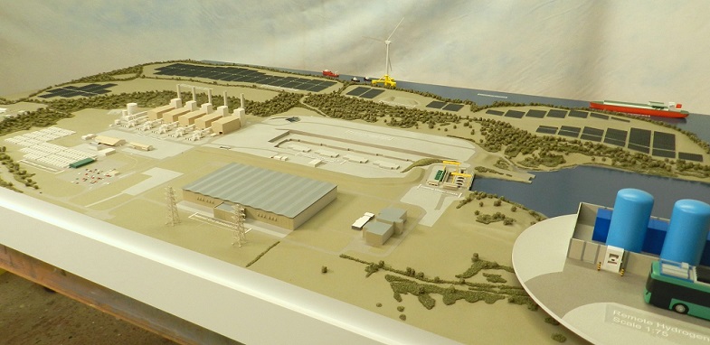
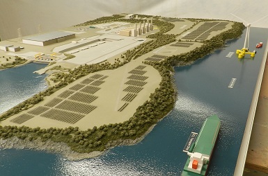
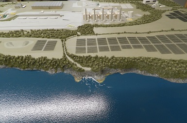
Featuring the site of a gas-fired power station on the Pembrokeshire coast, this large topographical model was built at 1:1000 scale which is an ideal scale option for a large spread-out site. At this scale 1 millimetre represents 1 metre so a 2Km long site fits onto a 2m long base which is big but still manageable, as long as you have space in your marketing suite. Even though the scale is small it still allows us to show a recognizable level of detail for any important buildings whilst any surrounding context buildings can be shown as massing blocks which helps to keep costs down.
Topographical contour model in 4 sections.
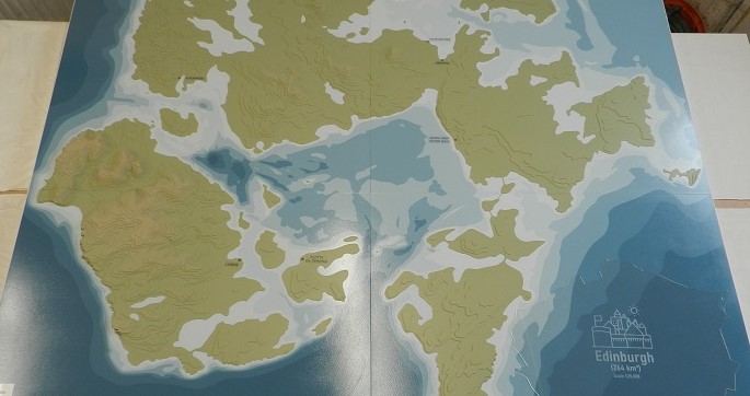
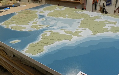
Orkney Islands Council asked us to produce this stylized representation of the Scapa Flow area which was to be used for marketing events and as focal point for internal meetings. Due to the size of the model (1.8m x 1.4m) it was constructed in four sections that could be stacked in a flight case for storage and transportation but could also be quickly fitted together when required. Although the islands show a simplified representation of the contours at 25m steps, the main purpose of the model was to illustrate the water depths in Scapa Flow and the surrounding seas. Sea charts normally show the deep areas in lighter blues but because this model was going to be viewed by mixed audiences the client asked us to reverse this colour coding and show the deeper areas in the darker colour. If you click on the main pic to enlarge it you’ll notice we also supplied a Perspex overlay which shows the relative size of Edinburgh to Scapa Flow. This is the third project we’ve completed for Orkney Islands Council this year.
Interactive model to illustrate best water management.
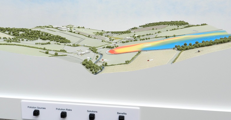
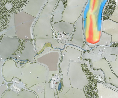
This interactive model was commissioned by the NFU as a visual demonstration to farmers of good water management practices on their land. The model shows two different catchments, one illustrating a high risk landscape with poor farming practices and the other showing a low risk landscape where the delivery of good practice minimises risks. The buttons on the front of the model activate LEDs set in the landscape to highlight different aspects of land management practice. The brightly coloured area shows an example of a Scimap, a graphic plan that shows farmers the risk areas across their land.
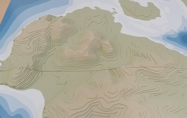
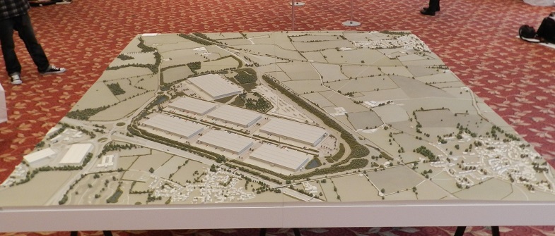
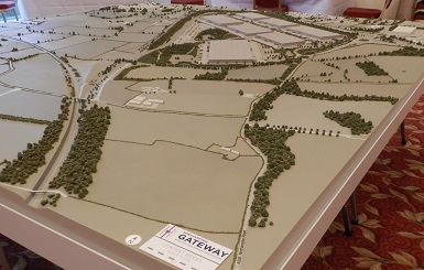
Landscape model with accurate topography.
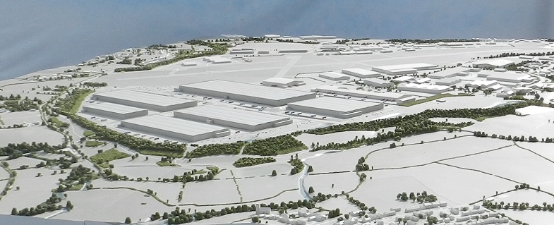
This large topographical model is 3m long by 2m wide and is made in four sections that butt together on adjustable height trestles. It’s the second large landscape model we’ve made for this client (see Recent Projects December 2016) and was commissioned as part of a public consultation process for a proposed development near Coventry. The aim of the model was to demonstrate how high embankments and landscaping around the site would screen it from surrounding villages so it was important that the on-site levels and surrounding topography were all accurately recreated. The buildings are shown as massing blocks due to the small scale (1:1250). Each metre is represented by just 0.8mm, so that the 16 metre high commercial buildings shown on the model are only approx. 13mm high.
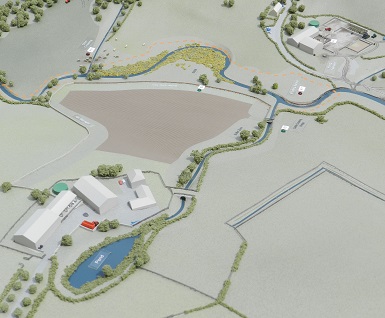
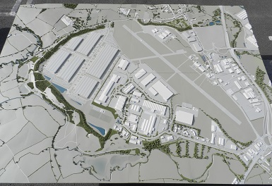
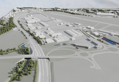
Accurate topographical model for public consultation.
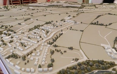
This 2.5m x 2.5m model was commissioned as part of a public consultation process for a proposed development just off the M1. Comprising 6 A0 sized sections, the purpose of the model was to demonstrate how high embankments and landscaping around the site would screen it from surrounding villages. For this reason it was important that the proposed on-site levels and surrounding topography were all accurately recreated. The buildings are only shown as massing blocks due to the small scale (1:1250). Each metre is represented by just 0.8mm, so that the 16 metre high commercial buildings shown on the model are only approx. 13mm high.