Topographical contour model in 4 sections.
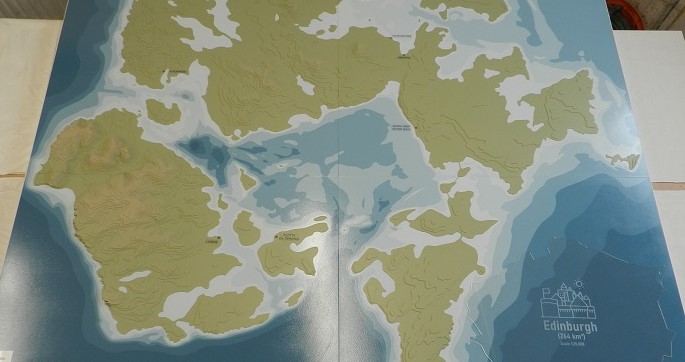
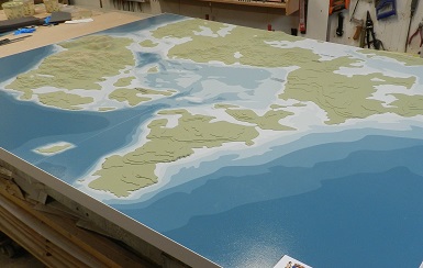
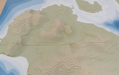
Orkney Islands Council asked us to produce this stylized representation of the Scapa Flow area which was to be used for marketing events and as focal point for internal meetings. Due to the size of the model (1.8m x 1.4m) it was constructed in four sections that could be stacked in a flight case for storage and transportation but could also be quickly fitted together when required. Although the islands show a simplified representation of the contours at 25m steps, the main purpose of the model was to illustrate the water depths in Scapa Flow and the surrounding seas. Sea charts normally show the deep areas in lighter blues but because this model was going to be viewed by mixed audiences the client asked us to reverse this colour coding and show the deeper areas in the darker colour. If you click on the main pic to enlarge it you’ll notice we also supplied a Perspex overlay which shows the relative size of Edinburgh to Scapa Flow. This is the third project we’ve completed for Orkney Islands Council this year.